Electronic conspicuity requirements for U-space and ADS-L are being defined now, in Europe. They will decide which devices count, how often a position must be sent and over which channel, and they will apply to aircraft as different as a light aircraft at 200 km/h, a glider circling in a thermal and a paraglider at 35 km/h. Drone makers, mobile operators, service providers and general aviation all sit at the table, each with its own assumptions about how aircraft show up. Data on how they actually do, kind by kind, has been scarce.
The aircraft furthest from the usual assumptions is free flight. Some 200,000 paraglider and hang glider pilots fly in Europe, about 110,000 of them in the national federations that make up EHPU. They carry their aircraft up a mountain in a rucksack and take off from a slope, where nobody can check what is in the rucksack; what every one of them carries is a phone. A requirement designed around an airfield may simply not reach them, which is why they are so often left to a footnote. The Electronic Conspicuity Monitor measures how every kind of aircraft shows up, continuously and in public, and gives every answer separately for powered aircraft, gliders and free flight.
This page explains why the monitor exists, how it measures, and what kind of answers it gives. The technical parts are in the closed boxes: open them for the detail, or skip them without losing the thread. The full rules are on the method page.
What it watches
Electronic conspicuity is anything that tells others, electronically, where an aircraft is. For light aviation that means mainly four things: FLARM, the collision warning system born in gliding and now built into many free-flight instruments; FANET, the open radio protocol born in free flight; ADS-L, the standard EASA has defined for light aviation and U-space, already in use by radio on the same 868 MHz band as FLARM and FANET, with a variant over the mobile network in preparation; and phone apps, which send positions over the internet.
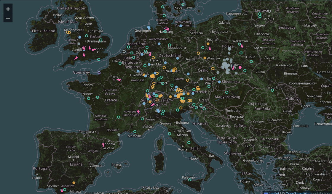
The monitor listens to the Open Glider Network (OGN), a volunteer network of ground receivers that publishes, in one open feed, what its receivers hear by radio and what some apps and platforms forward to it over the internet. On that feed the monitor measures for how long, and under which conditions, an aircraft stays visible to the network with a position close to the real one. Every answer is given per kind of aircraft: powered aircraft, gliders, and paragliders with hang gliders. That is the only way to show, with real data, where each kind of aircraft behaves differently.
Technical detail: the OGN feed and the two channels
The OGN feed is APRS, the format radio amateurs use. Each packet names its source in the destination field (the tocall): FLARM, ADS-L, FANET, OGN trackers, PilotAware, ADS-B, and each app or platform with its own.
A packet heard by a ground receiver carries the figures the receiver adds, signal-to-noise ratio in dB and frequency offset in kHz; one injected over the internet does not. That decides the channel, radio or internet, even for a source the monitor does not know yet.
The monitor sees only what OGN receivers hear. Two radio devices close to each other hear each other directly even where no ground receiver does, and that case is outside the measure. What the monitor measures is visibility to the network, the kind that U-space, drone operators, rescue services and tracking maps rely on.
Why numbers are needed now
Take a rule that looks harmless: “a position is stale if it has not been updated in the last six seconds”. For an aircraft at 240 km/h six seconds are 400 metres, and the rule makes sense. For a paraglider at 36 km/h they are 60 metres, the distance between two pilots in the same thermal. An instrument that sends a position every 150 metres, and so always keeps its position within 150 metres of the truth, would be called stale for most of the flight, and would have to transmit ten times more often than its movement needs, on a battery that must last a whole day.
Conspicuity and collision avoidance are different jobs
A hundred and fifty metres can sound like a lot to anyone who thinks of the FLARM beeping as a glider passes close. That is collision avoidance, and it works on another scale. Two devices a few hundred metres apart talk to each other directly by radio, through no network, once a second. They work out where both aircraft will be over the next 10 to 20 seconds and warn the pilot if the paths cross. There, tens of metres and single seconds matter, and a position 15 seconds old would be useless.
Electronic conspicuity serves those further away: the U-space service that authorises a drone flight, the operator flying that drone from ten kilometres away, the rescue helicopter entering a valley, someone following a pilot from home. What they need is to know that a paraglider is in that area and where it is heading, so as to keep clear of it in good time, with margins of hundreds of metres. For that, a position within 150 metres of the truth, which for a paraglider means an update at least every 15 seconds or so, does the job. A drone keeping 500 metres from a paraglider makes the same decision whether the dot on its map is right or 150 metres off.
The two functions have different needs, and one number cannot serve both. A phone cannot do collision avoidance, since it does not talk directly to the aircraft nearby, and radio remains essential for that. To be visible to the network a phone is enough, and it spends far less battery when it sends a position only when the aircraft has moved.
The monitor has three aims. To promote ADS-L, by radio and in its mobile variant, because a common language between light aviation, drones and ground services serves everyone. To keep the way open for phone apps, which for free flight are the only truly universal device. And to give regulators objective data, split by kind of aircraft, so that the rules work for every kind of aircraft they will apply to, from the fastest to the slowest.
Measuring in metres
A gap between two positions is judged by how far the aircraft moved in it. The monitor splits flying time into three levels: the position on the map is up to date while it is within 300 metres of the aircraft, approximate between 300 metres and one kilometre, and the aircraft is lost when it is more than a kilometre ahead of its last known position. For a paraglider 300 metres are about thirty seconds of flight and a kilometre a minute and a half of silence; an aircraft at 240 km/h covers the kilometre in 15 seconds. The same yardstick applies to everyone, and each aircraft is judged by how far it really moves. The 300 metres are twice the 150 of a distance-based sender, so that a single lost transmission does not trip the judgement, and roughly the distance beyond which a paraglider becomes hard to find by eye.
Technical detail: how lost time is counted
Two consecutive positions of a device on one channel form a segment. Between them, anyone watching the map sees the aircraft standing at the last position while it flies on. The part of the segment during which the aircraft was more than 300 metres, or one kilometre, from that position counts as approximate, or lost. Summed over all segments, this gives the share of flying time at each level.
A segment counts as flight when the speed at either end is at least 10 km/h, so a pilot walking up to take-off does not dilute the figures. Silence of more than 20 minutes starts a new session (device off, or a drive to another site). A segment implying more than 500 km/h is dropped, since it means an address shared by two devices. A packet arriving more than five minutes after its fix is ignored, so an app that regains coverage and sends its stored positions in a burst counts as invisible for the minutes it was silent: nobody could see it at the time.
The questions it answers
The monitor’s page opens with six questions, each with a live answer per kind of aircraft. The figures change as data come in; what follows is what each question looks at and why it matters to free flight.
Radio or mobile network?
Question 2 compares how much flying time each channel loses, for each kind of aircraft, and the answer differs from one kind to another. Height is part of it: mobile cells point at the ground, so an aircraft high above the terrain leaves their coverage while one flying low stays inside it, as question 3 measures. The page also checks that the comparison between kinds is not simply a comparison of heights, by reweighting every kind of aircraft to the same mix of heights.
The other part is the installation. A FLARM on a glider’s panel has the pilot right behind it; a powered aircraft may carry its antenna on the panel, on the canopy or under a metal fuselage; a paraglider pilot hangs in a harness with the instrument in front of the chest. The monitor measures the effect directly. While an aircraft circles, its transmitter faces a ground receiver from every side in turn, for equal times, so any side where packets go missing is a side the installation shields. The page translates the loss into range for each kind of aircraft: how far a receiver hears it from its weakest side, compared with its strongest. Free flight shows the deepest shadow, behind the pilot.
Technical detail: measuring an installation’s shadow
Only FLARM packets received while circling are used, circling being recognised from the turn rate FLARM sends or from the change of course between packets. For each packet, the direction of the receiving station relative to the aircraft’s heading is counted in one of twelve sectors. An antenna radiating equally all round would give every sector the same share.
Nearby stations hear almost everything from any side, which hides the effect, so the shape of the shadow is read from stations more than 20 km away, where a weak side means lost packets. Its size is read from stations within 5 km, from the signal-to-noise ratio corrected for distance, with at least 300 samples per sector. The two readings agree, with correlations between 0.90 and 0.95. Decibels become range through line-of-sight propagation, where the signal falls with the square of the distance: every 6 dB lost halves the range.
The stations are on the ground, below the aircraft, which is also banked while circling. The measure describes the shadow downwards, towards the ground network and towards aircraft flying lower. Towards an aircraft at the same height it may be stronger or weaker, and no ground receiver can measure it.
Does mobile coverage fade with height?
Question 3 gives the share of time lost by height above the ground. Mobile operators and a 2021 study for EASA put reliable coverage up to about 300 metres, patchy coverage up to about a thousand, and a lost link somewhere between 600 and 1,200 metres. The monitor shows the same fade for powered aircraft and gliders, and shows that free flight spends most of its time in the heights where phones work best.
Technical detail: height above the ground and its errors
Height above the ground is the altitude in the packet less the ground elevation from the NOAA ETOPO 2022 model at 15 arc-seconds, interpolated between the four nearest cells. In the Alps a cell is about 460 by 310 metres, and on the steepest ground the median error is about 30 metres. Relief smaller than a cell remains, so near a ridge, where a pilot may soar 50 metres from the slope, the model can be off by tens of metres. Errors of that size move a few segments across a band boundary; they cannot turn a band where apps rarely lose aircraft into one where they often do.
FLARM and ADS-L send height above the GPS ellipsoid and the OGN receiver converts it to altitude above sea level; FANET and OGN trackers send sea-level altitude directly. Nobody documents which altitude phone apps forward; one passing an Android phone’s raw ellipsoidal height would read about 50 metres high in Europe. This is being checked against pilots heard by app and by radio at the same time.
Should ADS-L carry the turn rate?
Gliders, paragliders and hang gliders spend much of their flight circling, often many in the same thermal. Anyone predicting where such an aircraft will be a few seconds later needs to know that it is turning. FLARM and the OGN tracker send their turn rate; ADS-L has no field for it, so a receiver must work it out from the last two packets it heard. When packets are lost, as they are when the pilot’s body shields the radio, those two can be many seconds apart, and in 16 seconds a paraglider in a thermal turns more than half a circle. Question 1 measures how far off the prediction ten seconds ahead is in each case, and how often paragliders suffer gaps that long: a field in the packet is worth most to the aircraft that lose the most packets.
Technical detail: scoring a prediction
For each received position P, at most one every 3 seconds per device, the monitor takes the position S 5, 10 or 20 seconds earlier and predicts where the aircraft will be at P four ways: a straight line along S’s course and speed, an arc with the turn rate derived from S and the position a few seconds before it, an arc with the turn rate S carries, and S itself, which is what a map shows. Each prediction is scored by its distance from P. Packet loss is emulated on the same tracks by keeping only S and the position 2, 4, 8, 16 or 32 seconds before it; 32 seconds is about the interval at which a phone app sends.
Seconds or metres?
Question 4 puts the six-second rule against reality: for each kind of aircraft, the share of flying time the rule would call stale, beside the share during which the position on the map had really fallen more than 300 metres behind. For fast aircraft the two are close. For paragliders the rule calls stale far more of the flight than was ever really behind.
Where phone apps work, and where aircraft disappear
Question 5 asks how much free flight happens in areas where phone apps keep aircraft visible, since that is the share a phone-based solution would cover today. Question 6 maps, square by square, where aircraft are lost and on which channel.
How much each kind flies, and on which systems
The monitor also counts flying time by kind of aircraft, each aircraft counted once whatever it was heard by, and how many aircraft transmit on several systems at once, which is interoperability as it already exists in the field. Free flight stands apart here: more than half of the paragliders the network hears transmit on two or more systems, most often FLARM and FANET from the same instrument, and almost every ADS-L transmitter heard so far also sends FLARM or FANET under the same address. Today ADS-L reaches the network mostly from free-flight instruments that speak several protocols at once.
Technical detail: what counts as one aircraft
Every transmitter identifies itself with a 24-bit address, the aircraft’s ICAO address or one assigned by FLARM or OGN. The monitor treats one address as one aircraft, and its systems as the sources that address was heard by in the month, on either channel. An instrument sending several protocols under one address is one aircraft on several systems, and so is a phone app set up with the address of the radio device on board, as SafeSky asks its users to do. Two devices with different addresses on one aircraft count as two. Flying time follows the same rule: every position of an address joins one timeline, whatever system it came from, so an hour of flight counts once even if it was heard three times.
What it cannot see
A pilot who carries nothing is invisible to the monitor as to everyone else. Radio counts stop where OGN receivers stop, dense in some valleys and absent in others. Apps count only if they forward positions to OGN, and in free flight few do today, so the phone’s share of free flight is the most understated figure on the page. Receiver coverage and mobile coverage are not spread the same way either, so a comparison between channels across different populations mixes the channel with the place and the pilot. The cleanest comparisons are the same device on both channels, the same pilot carrying two systems, and the same radio system on different aircraft, and the monitor moves in that direction as data accumulate.
Open data, and privacy
No track and no position of any aircraft is stored; the monitor keeps counts. Device addresses, which can be traced to an aircraft and its pilot, are kept for the current and the previous month and then reduced to counts and deleted. A device whose owner asked OGN not to track it is dropped on arrival and appears nowhere; one whose owner asked not to be identified appears without its model or registration. The figures can be downloaded from the same API the page uses, also as CSV, under the ODbL licence of the OGN data they derive from. The code is public and the method is written out in full, with a dated log of every change.
What you can do
If your instrument sends FLARM, FANET or ADS-L, register it in the OGN device database, choosing whether to be tracked and identified, so that it is counted as the kind of aircraft it is. If your app can forward positions to OGN, switch it on; if it asks for the address of the radio device on board, enter it, so that your aircraft shows once. If your app does not forward to OGN, ask its developer. And if you have remarks, corrections or questions about the monitor, the contact address is at the top and the bottom of the monitor’s page. Reports of figures that look wrong are the most useful of all.